Christopher Quock has a Master’s Degree in Entomology from San Francisco State University. His job history there includes work in research and as a teaching assistant. He’s a volunteer defender of Del Puerto Canyon, where a remarkable variety of wildlife and geologic history come together in a natural classroom and science lab. ed
Imagine visiting a nature space for years for recreation or school field trips. After a while, you learn when and where to look for certain plants, animals, and geological features. If you’re an instructor or teaching assistant, you eventually know the area so well that you integrate specific road side stops into your course materials. It feels almost as familiar as your backyard, if you’re fortunate enough to have one.
One day, you learn developers have been planning to build in the area, destroy many of those places, and reroute the public roadway you use to get there. You also find a project webpage and other documents where they claim that the place has been off limits and that there would be minimal impacts for public recreation.
In spite of your efforts to raise awareness about the natural, archaeological, and other cultural features that could be lost, more local and state leaders express their support for it. What do you do?
This is a question many who visit or live near and value Del Puerto Canyon have been dealing with for several years. Senator Anna Caballero recently wrote an opinion piece about the potential benefits of Del Puerto Reservoir for some agricultural interests in her district as well as sensitive habitats near Merced.
She joins other California officials who’ve voiced their support, including Congressman Josh Harder, who stated it would improve drinking water supplies in a letter to the California Water Commissioners, although its main focus will be holding water for sale to agribusinesses. Governor Gavin Newsom also requested funding from Secretary Bernhardt in 2020. The project is in limbo after a 2022 court ruling, but its proponents plan to resubmit a revised Environmental Impact Report (EIR) soon.
Yet, as others have mentioned, the canyon has been a destination for people from throughout California to enjoy and learn about the Diablo Range for decades. An independent survey out of UC Davis in 2023 found nearly 30 colleges, institutions, and other groups have regularly used it for recreation and education.
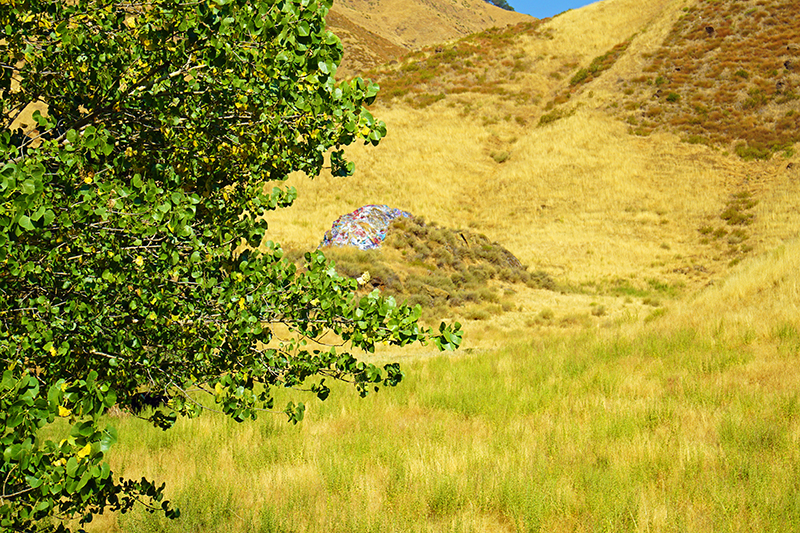
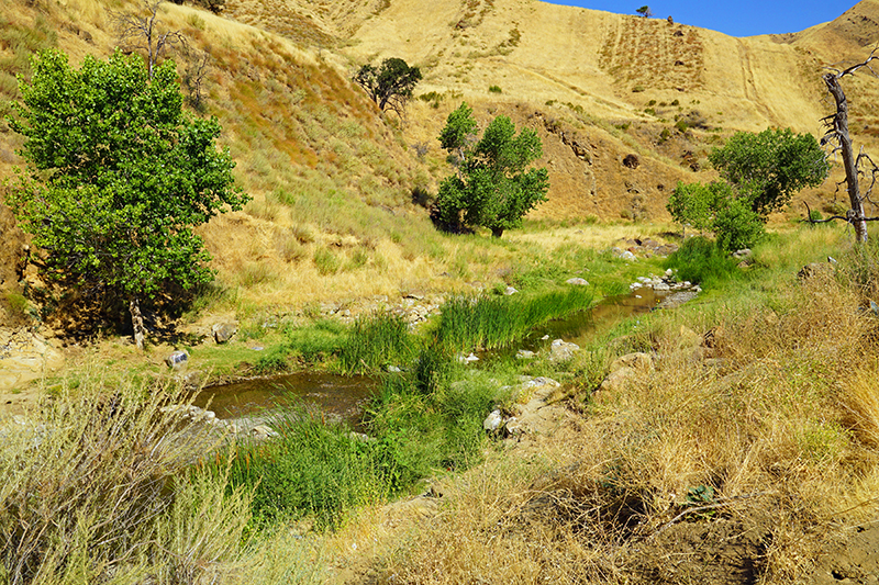
According to geologist Garry Hayes and others, the first dinosaur fossils to be identified from California were discovered in Del Puerto Canyon by a local teenager, and geology classes from places like Modesto Junior College still stop by the roadside to see where it happened. Contrary to claims made in Del Puerto Reservoir’s now defunct initial EIR, the site and the location where students stop are both in the canyon, just a few minutes drive east of Graffiti and Owl Rocks and within the footprint of the proposed project. It’s also a regular venue for the SF Randonneurs’ 200km brevets (recreational bicycle rides).
Although some Del Puerto Water District representatives claim the lands in the area are private with no public access, Del Puerto Canyon Road has an 80’ public right-of-way that includes the roadsides. Also, for both publicly and privately owned, undeveloped lands in California, boundaries noting where the public can’t go have to be clearly marked. While statements about providing possible replacement sites along a new roadway might satisfy some, they would not fully compensate for losses to activities depending on historical and cultural information tied to specific stops.
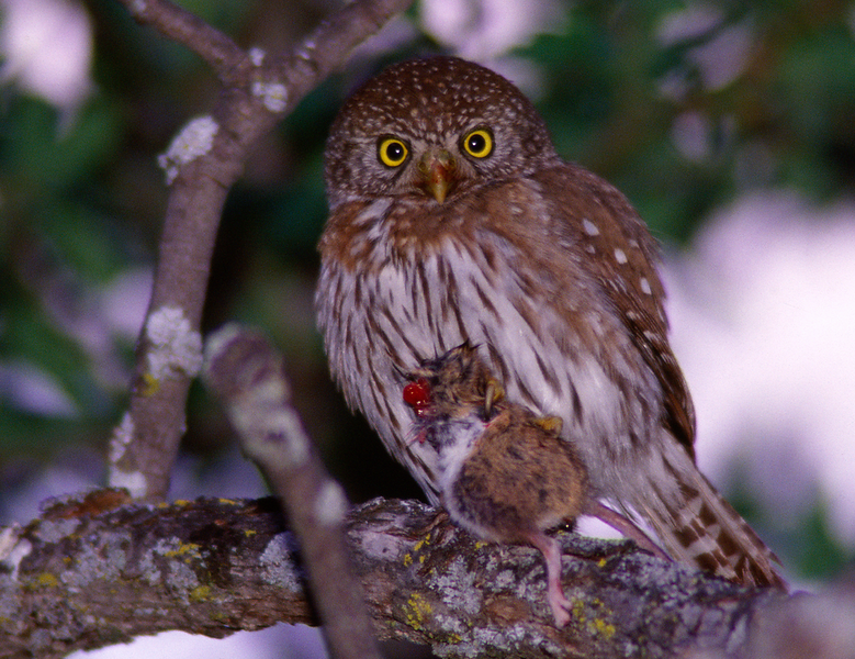
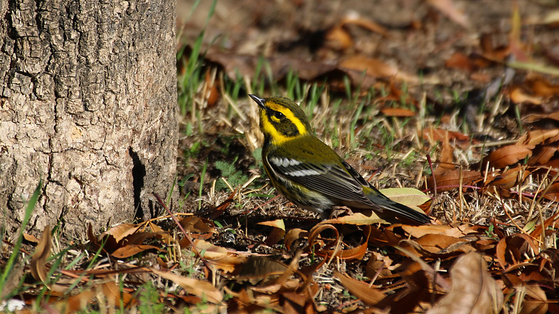
Del Puerto birds by Jim Gain


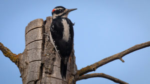

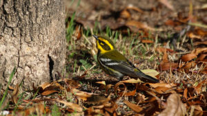

The fact that teachers and members of other groups have relied on this place for activities connected to their jobs continues to be relatively overlooked in the public discourse about the proposed project. Teachers have spent years of collective expertise and research to identify specific, publicly-accessible sites of interest and develop curricula around what students should expect to encounter in the canyon. This body of work is an essential part of designing effective field courses, whether they’re for budding geologists, birders, botanists, or experiential activities for entomologists in training. Thus, the debate over how much open space should be conserved and where can’t be simply boiled down to recreational leisure versus jobs. Del Puerto Canyon and the current configuration of the public county roadway and roadsides are already assets for some forms of employment in their current states.
In 2010, the majority Hispanic community of Patterson set a goal of achieving a minimum standard of 5 acres of publicly-accessible open space for every 1,000 city residents. In comparison, according to the Francisco Park Conservancy, the national standard is 10 acres of public green space per 1,000 residents.
According to Elias Funez, a former Patterson Parks and Recreation Commissioner and founder of Save Del Puerto Canyon, the reservoir’s footprint conflicts with pre-existing plans for a new public park. This is further evidenced by a series of city plans, the most recent of which were published in 2023, consistently showing and mentioning a park at the canyon’s entrance.
Who should get to choose which of California’s natural areas get saved and why? While efforts to deliver water to other sensitive habitats and some businesses are laudable, who should decide whether the impacts of storing and moving that water on other natural areas and the people who use them are worth it?
Should decisions over which lands are conserved or not depend so much on the interests of developers? Should the ability of grassroots efforts to successfully protect land and public access threatened by some business-backed interests differ by where they’re based?
In past struggles to conserve places like the Golden Gate National Recreation Area (1, 2) and the associated Marin Agricultural Land Trust, those battling rival plans by Gulf Oil, some ranching groups, and real estate interests to build the city of Marincello were portrayed as radicals with unrealistic and job-killing ideas. Some of those on the pro-development side also tried to portray themselves as members of the established elite who knew more about how to benefit the local community. Today, those protected areas are often taken for granted by visitors and the surrounding cities and towns that economically benefit from them.
Recently established Dos Rios State Park is a good beginning for new river parks, but public recreation areas in and around the Valley are still sparse compared to other parts of California.
Del Puerto Canyon’s current multi-regional appeal could be enhanced by creating a series of publicly-accessible county parks and land trusts around existing sites many residents of Patterson and surrounding communities already visit and value. As proponents of the dam have plans to release a revised EIR as soon as later this year and conservationists gear up for a second round, the fate of this possible future public benefit may be decided soon.
Thanks Chris, for providing a clear explanation of the benefits of maintaining this area of Del Puerto Canyon as a natural area.
Very well informed article. Local politicians, take note. Del Puerto Canyon is a unique cultural, recreational and natural science lab resource that is about to be destroyed and cut off forever from public access.
Thank you, Chris, for your wisdom and perseverance.
David Zelinsky
Chris:
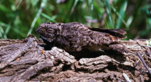
Excellent information. I have been on one of Garry Hayes’ geology tours. We saw and collected some fossil plants; saw from a distance the site where Bennison found his dinosaur skeleton; and the abandoned chromite and mercury mine. As a biology prof at Modesto Junior College, we could go to the Canyon to seek the road runner, wandering tarantulas (in the Fall), tree tobacco, and more. (That was decades ago, when I was employed.)
I am wondering if you know of an online site for folks to go to, to see curricula developed on the Canyon?
You forgot to mention that patterson included land in it’s general.plan for tract housing in the canyon. For some reason that always gets glossed over. Also the districts aren’t selling that water. The districts are the builders of the family for their own water as a buffer against increasing state regulations
All water districts sell water to their customers, or they’d go broke. The tract housing, schools, and parks are between where Del Puerto Road enters the valley and I-5. The public will have access to any parks in the valley, the reason the mayor and other city council members oppose the dam. Click on The General Plan Map. https://www.ci.patterson.ca.us/145/General-PlanCity-Maps
Del Puerto Canyon is an ancient passageway across the mountains, an area of historical interest. I wrote Senator Caballero that Ingram Creek at the Westley offramp is a much better location because there isn’t a public road going up Ingram Creek.
The land the city included for housing is in part of the canyon. The city called it Hillside Residential. The city that bends over to every developer that comes to town, the city that bases its Ag Mitigation Fees based on suggestions from the Building Industry Association. The city council that was told by its own Community Development Director and GP Consultant not to include any development in the hills west of of Hwy 5. Not a city or its leadership I would ever look to.
And that is why people like Claude Delphia fought it. It would be holding water to store because of increasing state water regulations.
Great job Chris! Thanks! Del Puerto Canyon was a favorite spot for me.
“…Data from our surveys and interviews reveal that …. nearly 30 colleges, universities, and other organizations indicated that they regularly use the Canyon for education and research. …”
The report does not specify where those institutions are from, but it should include at least one educational institution from Washington as well.